Measuring Mount Everest, the Rooftop of the World
Chinese surveyors are once again on a monumental mission to measure the world’s highest mountain.
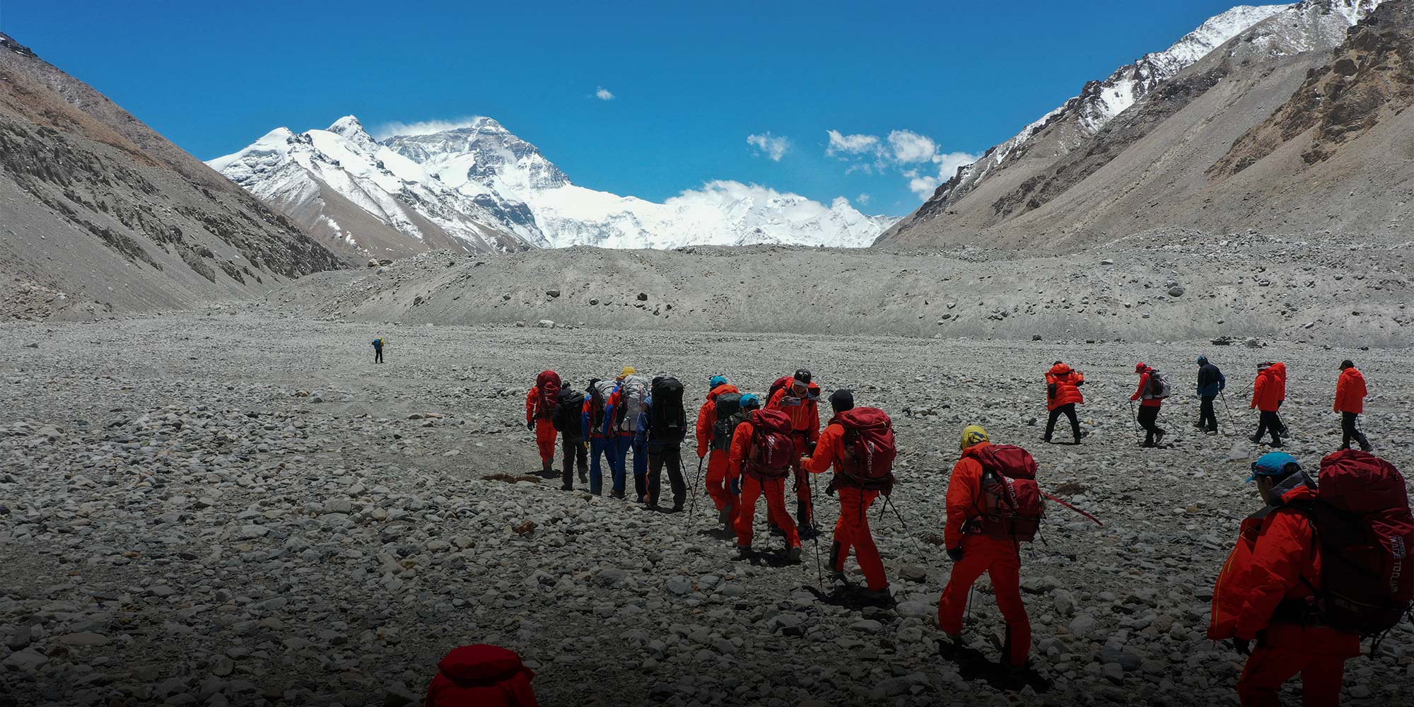
The team of 12 was expected to set foot atop Mount Everest on Friday, only to see their planned ascent thwarted by unfavorable weather conditions. The climbers, including members from the State Bureau of Surveying and Mapping, embarked on the expedition — the sixth scaling mission since 1949, though the measurements have only been released twice — on May 6.
Known as Qomolangma in Tibetan and Sagarmatha in Nepali, the mountain sits on the China-Nepal border. While 8,848 meters is the commonly cited height for Everest, disputes over the accuracy of this measurement — which dates back to the 1950s — continue.
Everest was first measured by the Survey of India in the 1850s, but it was their 1954 survey that determined the mountain’s currently accepted height. However, in 2005, a Chinese expedition announced a new height for Everest, excluding its snowcap: 8,844.43 meters.
The Nepali side disputed the new figure, arguing the snowcap should be included in the final height of the Himalayan peak. It later initiated its own measurement project, the data collection portion of which the country wrapped up last year.
During Chinese President Xi Jinping’s visit to Nepal in October, the countries issued a statement saying they will “jointly announce the height … and conduct scientific researches.”
Amid the ongoing debate over the measurement of the highest point on the planet, here are a few things to know about the Chinese expedition.
Why is China remeasuring Everest?
Everest sits atop one of the world’s most active tectonic zones: the juncture of the Indian and Eurasian plates, which are continually moving and colliding with each other. As a result, the mountain’s height may have changed over the years.
Some scientists speculate the magnitude 7.8 earthquake that struck Nepal in 2015 may have shrunk Everest by about an inch.
“Current estimates suggest Everest is 2.5 to 2.6 centimeters shorter than it was before the earthquake,” Dang Yamin, a geologist at the Chinese Academy of Surveying and Mapping, told Sixth Tone’s sister publication The Paper. “Current measurements are indirect results obtained via satellites, for example. We need to measure its height directly at the peak to determine the impact of the earthquake.”
Huang Wanli, a surveying expert at Fujian Normal University, told Sixth Tone this new measurement can also help scientists better study the overall plate tectonics in the region.
How will the mountain be measured?
Everest is inhospitable. Extreme weather conditions, including strong wind and low air pressure, can turn the place into a death trap. They also interfere with the workings of conventional altitude surveying equipment, Huang said. Even robots can fail.
As a result, the measurement team’s specially trained surveyors and mountaineers sometimes have to resort to more basic methods, such as trigonometry.
According to Zhang Peng, a surveying expert at China’s National Geomatics Center, surveyors on the current mission plan to set a beacon with several reflective mirrors attached on the summit. Then, scientists at a lower elevation will measure the slope distance to the top and calculate the height.
In addition, the team will carry equipment to retrieve location data from satellites, including China’s homemade BeiDou Navigation Satellite System. Climbers also plan to carry a radar to measure the thickness of Everest’s snowcap.
“Snow accumulation on Everest changes all the time,” Zhang told Sixth Tone. “Although it doesn’t make a difference to the public, we, as researchers, would want to know a more accurate rock height (excluding the snowcap) in order to study the Earth’s plate movements, for example.”
When will the new height be disclosed?
Dang the geologist said the result would likely be released later this year, and “preliminary calculations may be completed in September or October, if everything goes well.”
He said several factors, including temperature and air pressure, can affect the measurement. Therefore, scientists need to use various methods to calculate and calibrate the data, which can be time-consuming.
“This process can take two to three months,” Dang says.
All this just to measure a mountain?
Apart from the core mission of calculating Everest’s height, the expedition will also collect information on the mountain’s snow and glacier coverage, as well as the region’s ecosystem. The “firsthand data” generated will be used to monitor the impact of climate change and preserve the environment from further deterioration.
A 2018 report by environmental nongovernmental organization Greenpeace suggested that about one-fifth of China’s total glacier area has disappeared in recent years, threatening the water supply for 1.8 billion people in Asia. Glacial melt could also increase the risk posed by glacial lake outburst floods to communities downstream.
For now, the Chinese expedition team is camping at 6,500 meters, waiting for the weather to clear. Then, they will ascend to complete their mission of measuring Everest.
Editor: Bibek Bhandari.
(Header image: The expedition for measuring Mount Everest’s height starts its second attempt in Shigatse, Tibet Autonomous Region, May 16, 2020. People Visual)